Hurricane Irene
Hurricane
Irene, which swept up the East Coast of the United States from
August 27-30, 2011, is
expected to rank among the 10 most costly natural disasters in US
history. After making landfall as a diminished category 1
hurricane near Cape Lookout, Irene passed over Swan Quarter, about
15 miles East of PamlicoRiver.org's St. Claire Creek observation
station, around mid-day on August 27. The storm surge on the
Pamlico River was the greatest in living memory. The surge caused
extensive damage on the Neuse and Pamlico rivers, with significant
damage to >50% of piers near St. Clair, tornados
in Belhaven and epic flooding in Aurora. The 9.5 foot storm
surge in Oriental is documented by the Town
Dock. Irene
destroyed more than 1100 homes in North Carolina. Trees and
signs were down everywhere, streets blocked, homes flooded and power
out to millions of customers on the East Coast. Flood damage was
particularly extensive in Vermont.
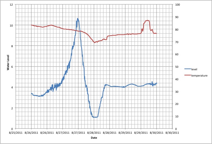
As illlustrated below, the surge at St. Clair Creek began to build
on the evening of the 26th of August. The full width-half max of the
surge goes from 6 am through 3 pm on the 27th, indicating 9 hours of
flood conditions during daylight. The surge was over 5 feet above
the highest water level observed over the past 18 months and 7.6
feet above the average level for 2011. The surge was followed by an
equal duration collapse in water level, ultimately below the sensor
level. Post storm the water level in the Pamlico was about 15 inches
above the pre-storm level, where it remains a week later.
Here is Irene's wind history at St. Clair:
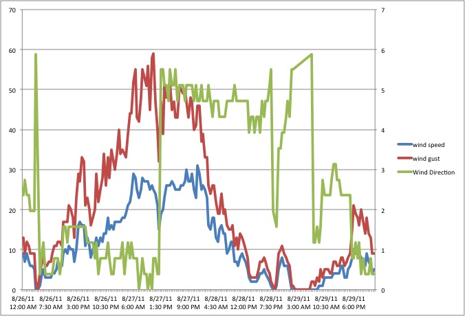
The wind direction goes from North at 0, East at Pi/2, South at Pi
and West at 3 Pi/2. The wind shifted from NE as the storm approached
to SW after the eye passed over.
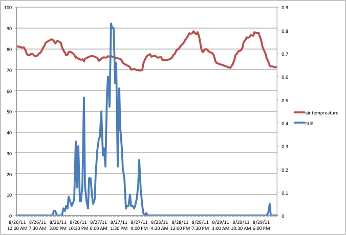
Here is the air temperature and the total rain in each 30 minutes: